Hurricane Otis slammed into Mexico early on Wednesday as the strongest-ever storm to make landfall on the country’s west coast.
Otis went from a Category 1 to Category 5 hurricane in only 12 hours — the fastest rate ever recorded in the Eastern Pacific Ocean.
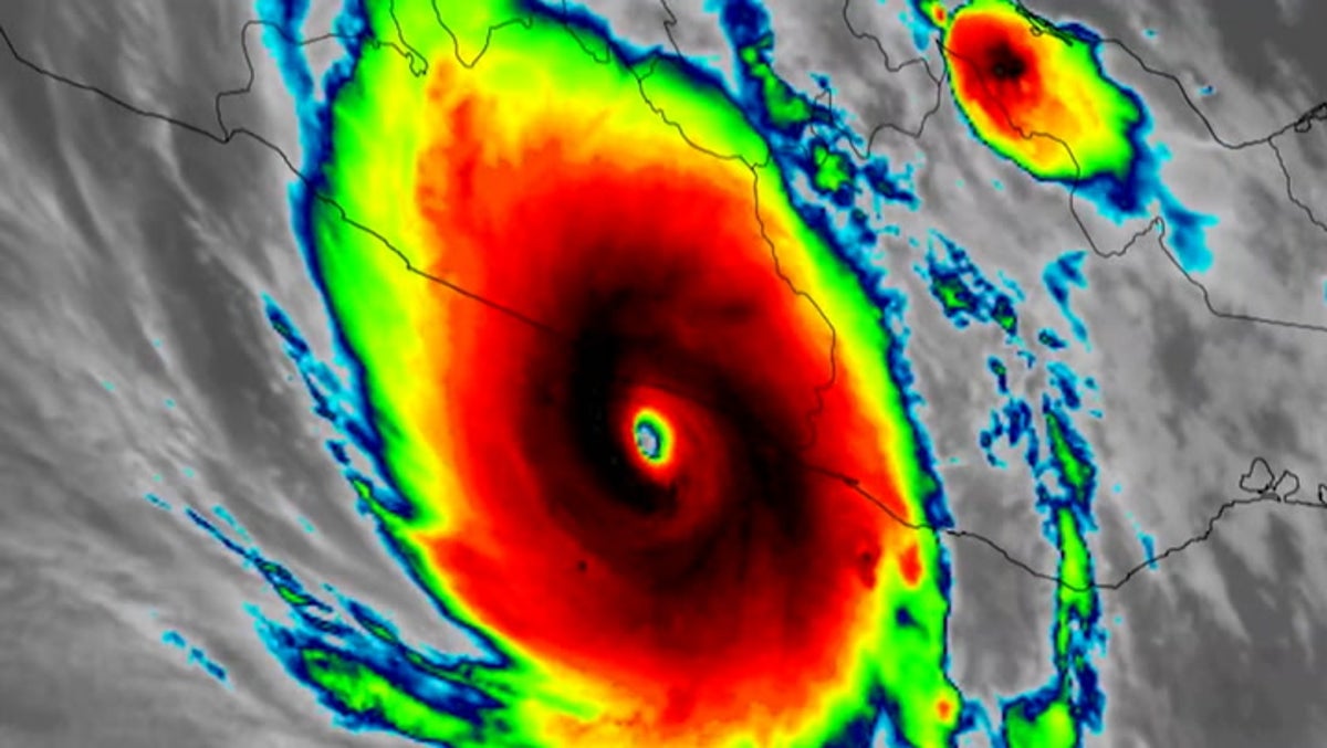
According to the National Hurricane Center, the eye of Otis made landfall close to the resort town of Acapulco around 12.25am local time with winds of 165mph. Forecasters described it as “a nightmare scenario” for southern Mexico.
The storm is tracking north through the country and is expected to dump five to 10 inches (13-25cm) of rain on Guerrero state with as much as 15 inches (38cm) possible in some areas. That raised the possibility of mudslides and flashfloods in Guerrero’s steep mountainous terrain.
The National Hurricane Center considers a storm to rapidly intensify if it increases wind speed by 35mph (46kph) in 24 hours.
While it is still too early to say what impact the climate crisis had on this individual weather event, record-breaking ocean temperatures are fuelling stronger and more destructive cyclones in general.
Heat in the ocean supercharges hurricanes with more moisture and stronger winds. This heat is being caused by a fossil-fuel driven climate crisis with El Nino, a cyclical weather pattern, layered on top.
The US National Oceanic and Atmospheric Administration (NOAA) says that the climate crisis’s impact on hurricane power is “like adding fuel to a fire”.
Sea level rise is compounding the danger. Since the late 19th century, global sea level has risen by eight inches – threatening coastal communities and increasing flooding risk when storms push water inland.
Rising sea levels can also wipe out natural coastal defences which act as buffers to hurricanes such as marshy wetlands and swamps.
With reporting from The Associated Press
Source link
